A guide to the evidence on debris, water systems, crops and habitats in the Gaza Strip.
Dated evidence, not a live situation report. Environmental baseline: September 2025 UNEP assessment. Debris update: April 2026 RDNA, covering October 2023–October 2025. Weapon reporting: 2023–2024 incidents. Evidence dates reconciled: 28 October 2026. Publication dates are not observation dates.
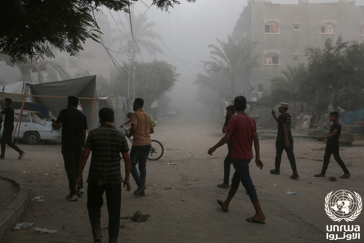
Deir al-Balah · 7 August 2024. People in a damaged street after bombing in Deir al-Balah, as identified in the original UNRWA caption. Photo: Ashraf Amra / UNRWA · Original & credit · CC BY-SA 3.0 IGO. Resized and compressed; full frame retained. Photograph provides historical context, not contamination measurements.
REFERENCE GEOGRAPHY
One place. Several kinds of evidence.
This map identifies Gaza’s five governorates. The findings below concern the assessment’s stated coverage; they are not assigned to individual governorates.
The documentary image, environmental assessment, and weapons report cover different periods and answer different questions. Their proximity on this page does not establish a causal link between a photographed incident and a measured environmental effect.
Reference boundaries only; no frontlines, access conditions, damage intensity or contamination shown. geoBoundaries gbOpen / Open Data Watch, PSE ADM2, 2017 boundaries, December 2023 build; CC BY 4.0. Extracted, projected and fitted for this display. Metadata · Geometry.
TWO ASSESSMENTS / DIFFERENT WINDOWS
Why do the debris figures differ?
The September 2025 UNEP assessment reports 61 million tonnes of debris. The April 2026 UN–EU–World Bank assessment reports more than 68 million metric tonnes for its October 2023–October 2025 assessment window.
Publication dates, coverage and reported debris estimates
Read these as separate estimates, not a measured increase. The assessments differ in their reporting windows and methods. Subtracting the figures does not establish debris generated between publication dates, and neither figure measures chemical contamination.
The water and vegetation findings below remain attributed to UNEP’s 2025 assessment. The later debris estimate does not update every environmental indicator.
Read every finding with its evidence type and limits.
Assessment method: remote sensing combined with observations from other UN agencies. UNEP staff could not enter Gaza. Published 23 September 2025; the brief does not identify one common observation cutoff.
REPORTED USE / DISTINCT FROM ENVIRONMENTAL MEASUREMENTS
Which weapons are reported?
Selected incidents from 2023–2024, described in the UN Commission of Inquiry report dated 27 May 2024. This is not a complete inventory or an update on current use.
Air-delivered bombs
The Commission reports Israeli airstrikes using explosive weapons.
Tank, artillery & naval fire
Israeli tank fire, artillery fire and naval shelling are described.
Rockets & mortars
The report describes Palestinian armed groups firing rockets and mortars into Israel, including on 7 October 2023.
General pathway to investigate: explosive impacts → damaged structures or services → debris or releases → possible contact with soil, water, or organisms. This is a conceptual chain, not a finding that every link occurred at a particular location. Weapon class alone cannot identify a chemical concentration, source contribution, or exposure.
Coastal testing and site-level debris chemistry remain limitations of this linked assessment. They are not evidence of an absence of harm. Targeted sampling could test the proposed pathways.
These gaps describe the sources summarized here, not the entire research literature. Recovery recommendations are distinct from evidence of completed recovery.
GO DEEPER
Choose your next question.
Where might a pathway connect?
Compare documented structural-damage points with a public-well snapshot by governorate, then document separate evidence chains. Input dates do not fully align; proximity is not a contamination forecast. Manual entries can be exported.
View the separate modeled lead image and its provenance limitations. Estimated concentrations are not field measurements and do not populate the screening tool.
Editorial synthesis of the existing Gaza atlas brief; not a systematic review or independent validation. Source checking does not update the underlying observations.